MAP Roads Act
USA119th CongressS-5181| Senate
| Updated: 7/30/2026
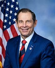
John R. Curtis
Republican Senator
Utah
Cosponsors (1)
Commerce, Science, and Transportation Committee
- Introduced
- In Committee
- On Floor
- Passed Chamber
- Enacted
This bill directs the Secretary of Transportation to create a pilot grant program aimed at modernizing county road data. The program will provide funding to states to support the digitization of county roads and the establishment of centralized, publicly accessible road datasets . The primary goals are to enhance rural commerce, improve public safety, and facilitate better public access and navigation. States applying for grants must demonstrate their ability to administer subgrants to counties and maintain a statewide repository for this crucial road data. Funds distributed to counties can be used to convert physical or outdated map formats into standardized geospatial datasets and to train personnel for data creation. Participating states are required to host this data on a public website, ensuring it is compatible with third-party mapping platforms and updated at least annually. The bill authorizes $20,000,000 annually for fiscal years 2026 through 2031 for the program. It also includes provisions to ensure the program does not alter existing legal jurisdiction over roads or permit the public disclosure of sensitive historical or archaeological site data.
View Full TextSuggested Questions
Get AI-generated questions to help you understand this bill better
Timeline
Introduced in Senate
Read twice and referred to the Committee on Commerce, Science, and Transportation.
Transportation and Public Works
MAP Roads Act
USA119th CongressS-5181| Senate
| Updated: 7/30/2026
This bill directs the Secretary of Transportation to create a pilot grant program aimed at modernizing county road data. The program will provide funding to states to support the digitization of county roads and the establishment of centralized, publicly accessible road datasets . The primary goals are to enhance rural commerce, improve public safety, and facilitate better public access and navigation. States applying for grants must demonstrate their ability to administer subgrants to counties and maintain a statewide repository for this crucial road data. Funds distributed to counties can be used to convert physical or outdated map formats into standardized geospatial datasets and to train personnel for data creation. Participating states are required to host this data on a public website, ensuring it is compatible with third-party mapping platforms and updated at least annually. The bill authorizes $20,000,000 annually for fiscal years 2026 through 2031 for the program. It also includes provisions to ensure the program does not alter existing legal jurisdiction over roads or permit the public disclosure of sensitive historical or archaeological site data.
View Full TextSuggested Questions
Get AI-generated questions to help you understand this bill better
Timeline
Introduced in Senate
Read twice and referred to the Committee on Commerce, Science, and Transportation.
John R. Curtis
Republican Senator
Utah
Cosponsors (1)
Commerce, Science, and Transportation Committee
Transportation and Public Works
- Introduced
- In Committee
- On Floor
- Passed Chamber
- Enacted